News and Notes on the
|
Or What could be the future
|
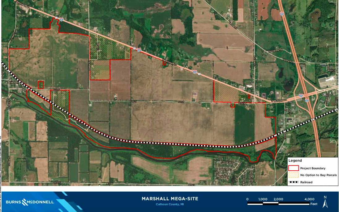 Here's a map of the Marshall Mega-site as depicted by the company Burns-McDonnell. First, Let me comment that the road depicted as I-94, is NOT I-94, but Michigan Avenue. I-94 is located to the North of this image. That mistake corrected, the map is an accurate depiction of the area showing the red outline of the Mega-Site. You'll notice the white dotted line of the working railroad tracks (one of the selling points for the Megasite). What is apparent is the number of acres of the Megasite which are located to the South of the tracks and between the Kalamazoo River. This land mass is substantial, perhaps as much as 200-300 acres of the Michigan Megasite. I know roughly 45 acres of the 300 acres of Riverside farm is comprised of this area along the river. So in fact, the Marshall Megasite is in reality only 1300 usable acres. You'll also notice the many subdivisions that eat into the Marshall Megasite with "No option to buy parcels". Why would these residents want to sell? Living in this rural country setting is ideal for residents, especially located close to Marshall. It's a way of life many people don't want to give up, no matter what the state offers.
0 Comments
Leave a Reply. |
Concerned CitizensWe are concerned residents who are oppossed to the State of Michigan's plant to create a 1,600 acre industrial park outside historic Marshall, Michigan. Instead we wish to see a 1,600 acre recreational area on this site which runs along two miles of the Kalamazoo River. Save Historic Marshall, Save Michigan's Agricultural Land and Protect Michigan's green spaces! Archives
May 2023
Categories |
 RSS Feed